Lab 2: Data Collection with multi-rotor UAS
By: Jackson Radenz
Introduction:
There are many advantages to using a multi-rotor UAS compared to fixed wing and/or VTOL unmanned aerial systems on the market. The greatest advantage of a multi-rotor UAS is its versatility and control. The multi-rotor UAS is easy to carry into the field (compact, is able to fit in a backpack), minimal set-up time (tighten rotors on UAS motors), and has an ease of control for a variety of missions. The rotors on the UAS enable it to fly much like a helicopter. Therefore, the UAS is able to take of vertically, ascend/descend, pitch, yaw, and roll with a large amount of ease with inputs from the controls. The functionality of a multi-rotor UAS allows for great versatility during the data collection. Data can be collected obliquely and vertically (nadir). This allows for a wide variety of missions to be accomplished. The oblique data collection option allows the surveyor to collect data on a damaged building or inspect gutters, while the nadir view allows data to be collected about topography, agriculture, vegetation, or water quality; just to name a few. Both views can be joined together to make impressive point clouds which can lead to accurate DSM outputs.
In this study, we used Douglas Kerns' multi-rotor Phantom 4 Pro UAS equipped with an RGB payload.

Figure 1. Phantom 4 Pro with RGB payload attached
Study Area:
Myrick Park: La Crosse, Wisconsin
43°49'22.02"N
91°13'30.62"W

Figure 2. Study area (Myrick Park, La Crosse, WI)
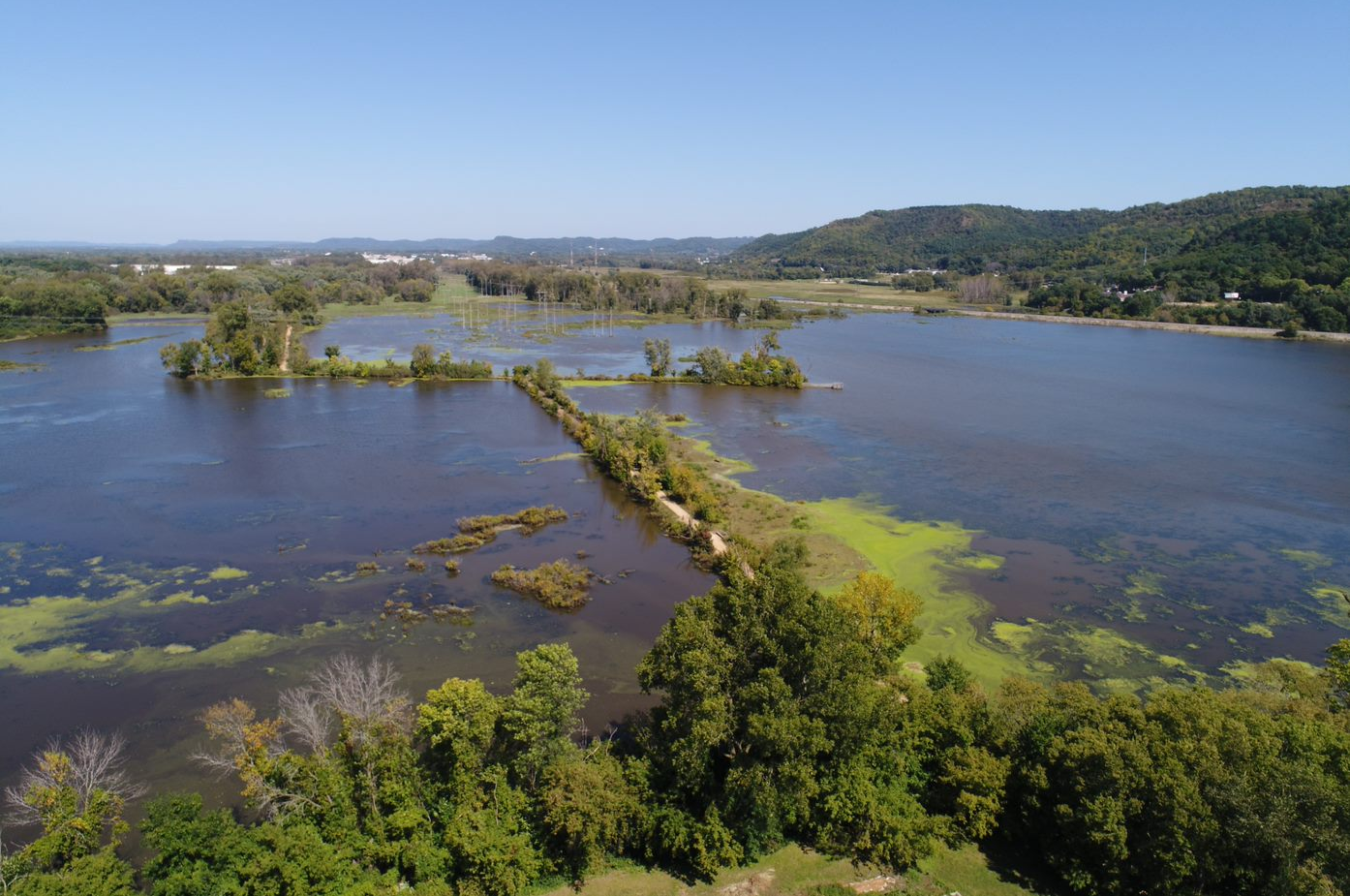
Figure 3. (below)

Figure 3 & 4. Oblique image captured by UAS of study area
Data was collected near the gun shelter located in the city of La Crosse at Myrick Park. Myrick Park was home to an old shooting range. It was not until the 1960's that Myrick Park was designated as a preserve and become submergent wetlands. When large rain events happen within the city of La Crosse, these wetlands are a 'sponge' that prevents large amounts of flooding. When the Mississippi and La Crosse River are running at high water level marks after large rain events, they are able to distribute some of their flow here so the city (which mostly sits on a flood plain) does not become overflown. Possible obstacles located within the study area are low lying powerlines, guy wires, eagles/hawks, and helicopters flying to Gunderson Hospital and low altitudes. This study area provides us with an otherwise very open area to be flow with trees reaching a maximum height of 30 - 40 feet. The land below consists of marshland/submergent wetland (70 - 80 % water, 20 - 30 % land). Water is contaminated with lead (bullets) from past land use.
Data Collection: Vertical Mission
Application: Ground Station Pro

Figure 5. Nadir mission parameters (Screenshots from ground station pro)

Figure 6. Nadir mission parameters (Screenshots from ground station pro)
Size of mapped area: 3.59 HA
Flight length: 1416 meters
Waypoints: 98
Flight time: 12:47
Discussion:
96 photos were captured throughout the course of the 12 minute 47 second flight. The mission acquired imagery over the gun shelter near the waters edge located at Myrick Park. The ground control station was located 10 feet east of the gun shelter in order to provide optimal connectivity with the Ground Station Pro app and the UAS. The southwest corner of the wetlands were also included in the mission and will be a product after post processing is completed.
Conclusion:
The mission's 96 photos and their corresponding geotags will allow for an accurate (+/- 2 meters) orthomosaic to be produced. Corresponding with each picture, the pitch, roll, and yaw was recorded, therefore a point cloud and digital surface model will also be developed. The objective of this mission was to introduce ourselves to the technology of the UAS and ground station pro, communication between Ground Station Pro and Phatom 4 Pro, test the accuracy of orthomasic production, and collect data over two different types of land cover.